Review highly updated property imagery to make more efficient and profitable updates to renewals policies.
When it’s time for an insurance policy to be renewed, high-quality and updated imagery is key to understanding how a property has changed since the initial time of underwriting. Near Space Labs offers timely, high-resolution imagery of areas such as landscapes, cities, farms, and rural locations, to provide a more comprehensive view of how properties look at the time of renewal, helping to increase ROI and customer retention rates.
With 90 day refresh rates, our imagery shows detailed changes that occur on and around residential and commercial properties – giving underwriters the confidence they need to make accurate adjustments to premiums and underwriting policies.
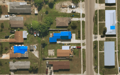
Insurers can visualize new potential hazards like vegetation encroachment or damages to the property, to help inform their customers and mitigate risk where they can. For residential areas, additions of swimming pools, tool sheds, and solar panels are easily identified. For commercial properties, underwriters can identify updated roofs, HVAC systems, and sidewalks. By capturing properties before and after renewal periods, our imagery provides detailed, reliable views so underwriters can profitably determine how a policy will, or in rare circumstances, will not be renewed.
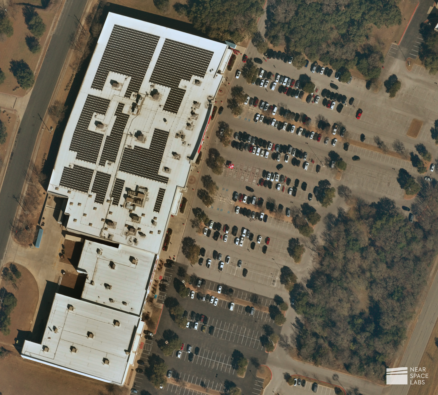
Retail parking lot and building. Near Space Labs. January, 2022.
According to the Independent Insurance Agents of Dallas, customer acquisition costs in the insurance industry are 7-9 times higher than the cost of retaining an existing customer. Remote monitoring is used to help increase customer loyalty by enabling seamless customer experiences, reducing wait times, and increasing the overall efficiency of the renewal process. To help automate the underwriting and renewal process, our geospatial data is able to plug into machine learning models via an API to help underwriters or algorithms detect change, inform risk, and help insurers automate the decision process for consistent and profitable adjustments to policies. Through updated property snapshots using high-resolution stratospheric imagery, insurance companies are making more informed strategic decisions, decreasing customer churn rate, and increasing profits.
Benefits of Near Space Labs’ imaging for insurance renewals
Ultra High-Resolution Images
Our 10 cm resolution imagery helps insurers and machine learning models detect changes to properties, whether that be new damages to the property or surrounding area or additions to the property such as new gazebos, decks, trees, or swimming pools.
Tasking for Specific Areas of Interest
Do you have properties in rural or remote areas not covered by other imagery providers? We offer customizable tasking for areas outside of our top 100 most populous cities capture plan. Our remote technology gives insurers the same high-quality data of rural locations that they can expect from the more frequently covered urbanized areas while minimizing the need for timely and costly on-site inspections.
Reliable Geospatial Data Parter
At Near Space Labs, we deliver high-quality data on-time to our customers and do not compromise on resolution, frequency, scale of capture, or sustainability. We build, design, and deploy our Earth imaging technology with our customers in mind to capture highly updated and valuable geospatial data to enhance the speed and efficiency of the renewal process.