Validate claims and assess property conditions with historical stratospheric geospatial data for more accurate and efficient claims processing
Near Space Labs offers high-resolution imagery with 90 day refresh capture rates for more precise and accurate claims assessments. Claims departments need reliable imagery to see the truth on the ground before and after a claim is made to 1) verify the details and scope of the reported damage and 2) determine a fair and profitable payout price if the claim is valid.
According to Deloitte, fraudulent property-casualty claims cost the insurance industry roughly $30 billion dollars each year. With updated high-resolution imagery, claims adjusters can quickly confirm claims involving damage caused by weather-related instances, hurricanes, fires, floods, earthquakes, and other natural disasters. At a fraction of the time and expense, insurance companies gain incontestable proof of whether a claim is fraudulent using georeferenced and time-stamped data, thus enhancing the speed and efficiency of claims processing. With frequently updated imagery, adjusters are also able to assess whether damage is from normal wear and tear, fraudulent activity, or if the damage was caused by an insurance-covered impact.
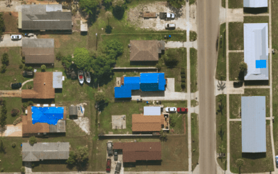
Residential community showcasing alligator cracking in roads, swimming pools, outside furniture, and surrounding landscapes. Near Space Labs. May 2022.
When a claim is verified, our imagery provides insights into the cause and severity of damages to public utilities, commercial or residential properties, roofs, fences, gazebos, surrounding landscapes, and more. Our Swifty technology flies 60,0000-85,000 feet in the stratosphere, which allows us to capture these finite details at a city-wide scale and helps claims adjusters monitor entire neighborhoods or commercial areas in minimal time. After events such as a hurricane or flood where physical inspections are not possible or safe, remote inspections help gather timely data that otherwise may have been lost while waiting to conduct a physical inspection.
Benefits of Near Space Labs’ imaging for insurance claims
Scalable Coverage with Remote Inspections
Our Swifty technology captures up to 1,000 sq km in a single flight, or roughly the area of New York City’s five boroughs. Wide-scale coverage allows claims adjusters to view their properties holistically, without spending long hours visiting properties on foot to validate and assess a claim. For example, say a natural disaster occurs which potentially damages dozens of cars at a dealership. With our wide-scale coverage, we provide comparisons of asset conditions pre- and post-disaster, help validate if damages exist and show the extent and cost of claims to help insurers quickly determine and administer profitable payout amounts. Or when the unthinkable happens, like a tornado, our Swiftys are able to capture the storm’s damage path and provide timely visualization about the affected areas, including homes, commercial properties, and farmlands in minimal time, helping to quickly assess claims and provide relief to customers.
Ultra High-Resolution Images
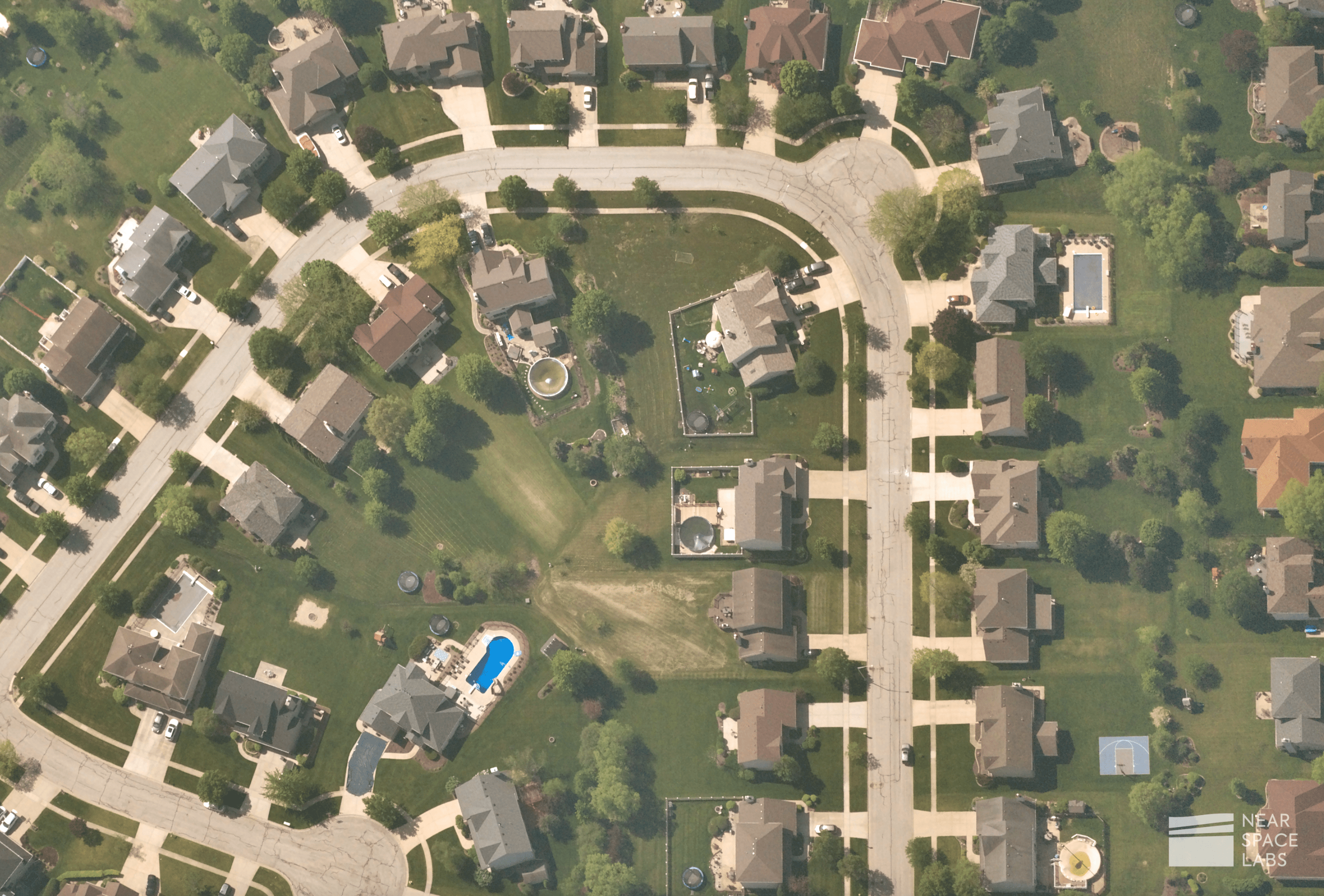
In order to understand the scope of an insurance company’s liability, a detailed view of the truth on the ground is vital. Our 10 cm resolution images provide visibility into details such as changes on the property, fallen trees, damages to water or electrical utilities, and more. Our ultra high-resolution images clearly show objects as small as a soccer ball.
Rapid Response
Our nimble technology allows our team to react quickly to unforeseen events like natural disasters. Since our balloons fly in the stratosphere, we are able to work around commercial airspace regulations to image events soon after they occur without needing to wait for catastrophe conditions to clear. This allows us to safely conduct captures well ahead of when airplanes would be able to deploy.
Due to our Swifty’s nimbleness and ability to deploy quickly, we are also able to wait for a break in cloud coverage to image the effects of catastrophes quickly. This is an advantage over satellites who are stuck in orbital rotations and aren’t able to plan proactively around clouds.
Tasking for Specific Areas of Interest
We offer custom capture requests for remote and rural areas that are currently not covered by other imagery providers, making us the most reliable source of geospatial data on the market.
Geospatial Data Without Compromise
With Near Space Labs’ stratospheric technology solution, insurance organizations are equipped with the most up-to-date, high-quality geospatial data on the market for enhanced claims assessments. Start making more accurate and profitable decisions today with Near Space Labs.