Balloon technology is broadening access to high-quality Earth imagery faster than satellites, airplanes, and drones
Near Space Labs was founded with the mission of maximizing the impact problem solvers and innovators can make around global challenges. Our founders realized that other imagery providers have limitations around the resolution, coverage, and frequency of data they can provide, which restricts visibility into problems and ultimately hurts communities. By providing high-quality, high-frequency 10 cm imagery, businesses and communities can easily track and analyze changes so they can make informed decisions about climate change, urban planning, community safety, and monitoring risk.
The secret behind Near Space Labs’ imagery is the Swifty, our proprietary Earth imaging technology. A Swifty is a small robot attached to a sophisticated weather balloon that travels 65,000-80,000 feet in the stratosphere to capture ultra high-resolution 10 cm, georeferenced imagery of communities and environments. Swiftys are designed, built, and manufactured in-house which allows us to tailor our technology to serve our customers’ needs. With our solution, there are no tradeoffs between resolution, frequency, customizability, and sustainability.
Below, we’ll walk through some of the fundamental differences around the method and quality of imagery captured from Near Space Labs, satellites, airplanes, and drones.
Near Space Labs vs Satellite Imagery
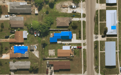
Let’s start with satellites. Satellites typically compromise resolution in order to gain frequency, meaning they may be able to provide frequently updated images but often with much lower quality. This poses problems for companies that need to identify sharp details and changes on the ground, such as roofing conditions after hurricanes, the types of cars in a parking lot, and construction progress of new developments.
The nature of satellites also inhibits them from being flexible with their imagery captures. Since satellites are bound to orbit, they are unable to be customized by their capture time, date, and location. Clouds also pose a challenge for satellite imagery customers. For example, say your area of interest (AOI) is a large community in Austin, Texas and you need imagery captured at noon to minimize shadows. If there is cloud coverage at the time the satellite is imaging your area, for one, you will still be required to purchase the unusable image, and two, you must now wait for another orbital rotation to try again. If there are still clouds, the process repeats, which could cause delayed projects and unreliable time management.
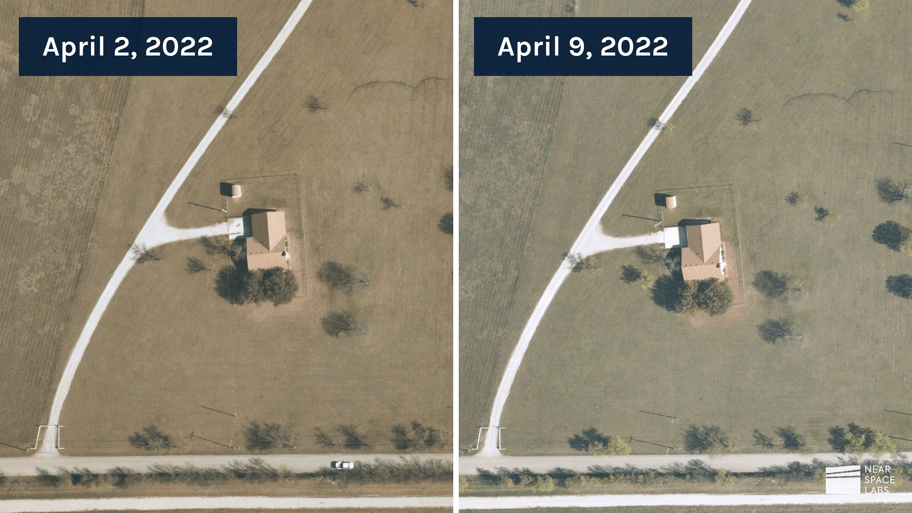
With our nimble technology, we are able to launch from nearly anywhere at any time of the day, which allows us to work around clouds more efficiently. In the previous example, while satellites must wait to complete another full orbit, we can wait for a break in the clouds and send our Swiftys into the stratosphere as soon as the clouds clear to capture your AOI as close to the desired time as possible. That means with Near Space Labs, you do not pay for cloudy images, you can rely on timely data, and you can plan project timelines with more certainty and consistency.
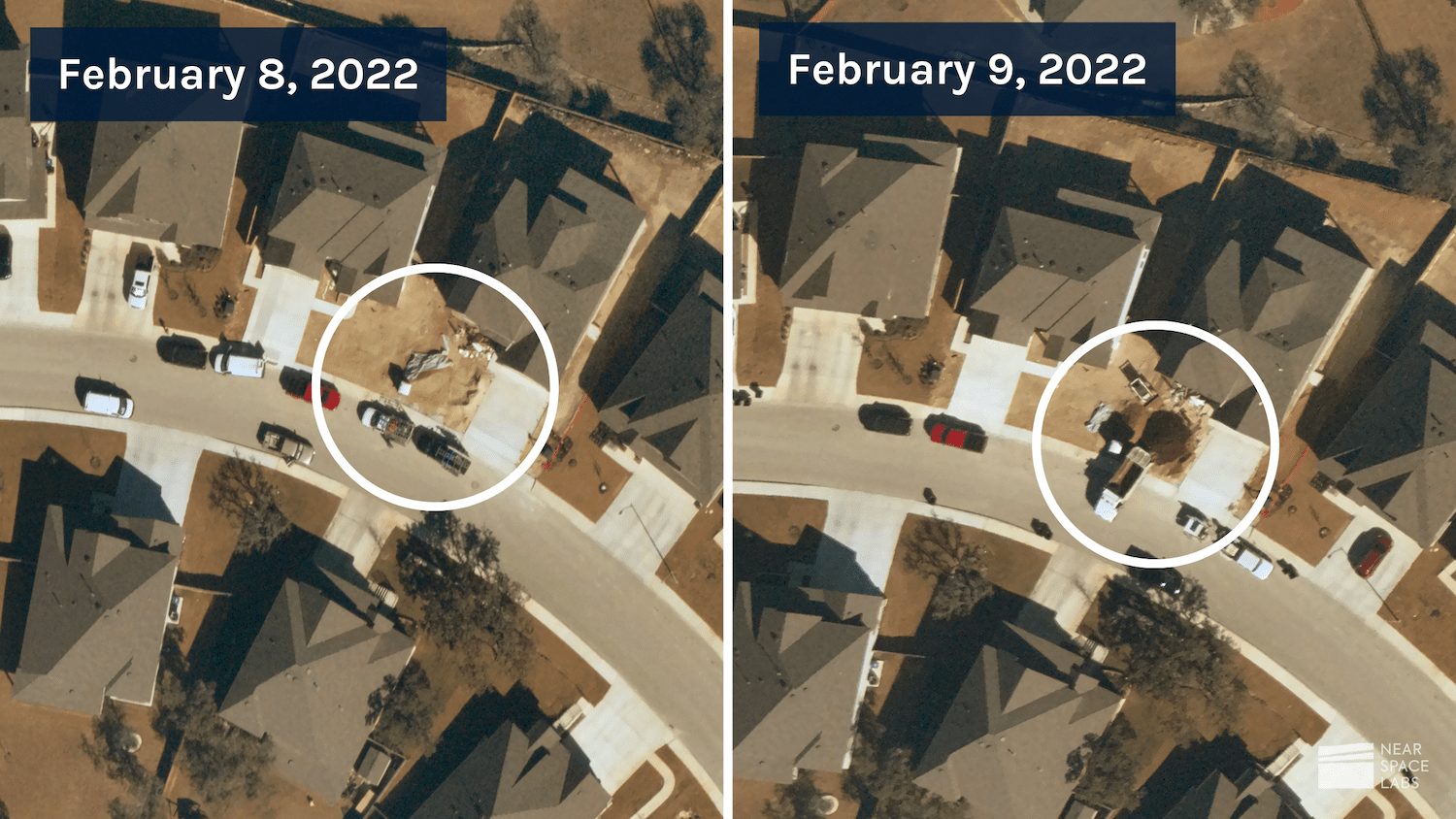
Our high-frequency capture of a Texas neighborhood, showing daily changes to the front landscape.
Near Space Labs vs Aerial Imagery
Since airplanes fly at low altitudes, they are able to capture high-resolution images of urban areas, but not without compromising on frequency. It is very expensive to task an airplane, and takes many resources to deploy for a mission. Due to these limitations, daily, weekly, and even monthly capture rates via airplanes are unheard of.
A Near Space Labs Swifty can capture an area five times or more per day, giving customers the ability to truly customize frequency rates to their required cadence. For example, many construction projects require daily updates from their employers on development progress. Another use case that poses challenges for airplanes is post-catastrophe response.
Planes must adhere to strict commercial airspace regulations, and wait for conditions to clear in order to fly after a catastrophe. Each day waiting for restrictions to lift, the details and value of data collected diminishes
Since we fly in the stratosphere, we can deploy directly after an event occurs to capture timely data and provide visualization of the conditions on the ground to first responders and emergency response organizations. With frequent flights following the disaster, we also help enhance the speed of recovery and clean up and can help identify ways to mitigate risk from future events.
Another difference between Near Space Labs and aerial imagery is that aerial providers tend to focus their high-resolution captures in densely populated urban areas, and often don’t cover rural ones. And when they do cover these areas, the quality of resolution lessens – meaning, urban areas are usually covered in higher resolution while less populated ones are captured in lower resolution. Thus, these smaller cities and remote locations usually lack access to high-quality data of their communities leaving decision makers to draw conclusions with outdated and low-resolution data.
Our imagery captures are customizable and can easily be tasked to capture high-resolution imagery at the desired frequency needed – whether they’re second-tier cities, suburbs, rural areas, or farmlands. We pride ourselves on being a reliable data partner that will help you capture high-quality 10 cm data of your AOI, even if it’s outside frequently covered cities.
High-frequency capture of a rural area in Haslet, Texas.
Near Space Labs vs Drone Imagery
Drones, or unmanned aerial vehicles (UAV), provide ultra high-resolution imagery of local areas, but lack a fundamental quality that businesses and organizations need to be successful – the ability to scale. Drones can only fly for a short time over a small area, and require a person to be onsite to control its flight.
Our Swiftys capture up to 1,000 sq km of ultra high-resolution imagery per flight, which equates to imaging about the size of all of New York City’s five boroughs in a single flight. To put it in perspective, it would take drones at least 200 flights to image the same area. The ability to capture large swaths of land in minimal time is important for many use cases and businesses, including insurance organizations who need to underwrite thousands of properties remotely and city planners who need to understand the spatial layout of lands.
Also, due to FAA restrictions and other regulations, drones are often unable to fly over specific areas such as densely populated cities and airports. Some cities may require permits to be obtained before flights, and others, like New York City, have outlawed drones completely. So while drones may be good for small, one-off projects, they lack the ability to scale and have strict regulations on when and where they can fly. With Near Space Labs’ 10 cm resolution, businesses can create scalable solutions using high-quality geospatial data.
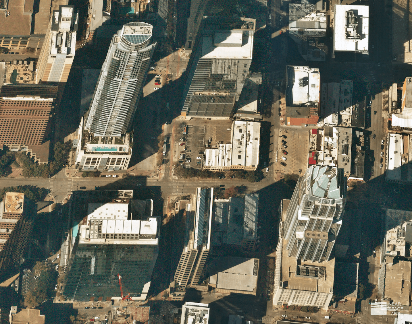
10 cm capture of downtown Austin, Texas.
Near Space Labs’ Zero-Emission Solution
Another major difference between other earth imaging technologies and Near Space Labs is that our Swifty is a zero-emission solution. Unlike satellites, planes, and drones which contribute to space junk and pollution, our earth imaging technology is the only green solution for collecting high-resolution geospatial data. Companies can use Near Space Labs to enhance or reach ESG initiatives and goals.
Earth Imagery Without Compromise
To recap, satellites often compromise on resolution to gain frequency, planes often compromise frequency to gain resolution, and drones are limited by restrictions and are unable to capture wide-scale areas. At Near Space Labs, we pride ourselves on being the most reliable geospatial data partner on the market, providing customizable captures to produce high-resolution, high-frequency RGB imagery at scale.
For any questions or to see how we can help your business with high frequency 10 cm imagery, please contact us below.