Properly leveraging multiple highly-accurate data sources will help build detailed and reliable smart cities around the world
What is a Digital City?
More and more, all aspects of cities are coming online – from transit, to energy, to the mechanical infrastructure under our roads. As this happens, we move into the realm of digital and smart cities.
The goal of digital and smart cities is to use data to become more efficient, promote economic growth, and improve the safety and quality of life for citizens. They allow for rapid assessments and enhanced decision-making based on data-driven software models. Some of the top smart cities in the world include Singapore, Copenhagen, Dubai, Boston, and New York.
Digital cities/twins, like their physical counterparts, can be incredibly complex. Even the simplest data points, when made accessible to the right people, become valuable. For example, data collected for smart cities can help optimize traffic routes and reduce congestion, improve urban planning, and enhance sustainability.
For the sake of this blog, we will be using the terms ‘digital city’ and ‘smart city’ interchangeably.
What challenges do Digital Cities face?
There are two broad challenges that organizations face while building digital cities – access and alignment. Access meaning, ‘can I get the data I need’ and alignment meaning, ‘How do I make all of this data work together?’
Let’s start with access. To create an accurate and reliable digital city, one data source isn’t enough to give you a full picture. Deriving meaningful insights about your environment requires multiple data types to be layered together to build a holistic and dependable view of the area you’re investigating. These data layers must be individually accurate and reliable in order to build on top of one another in a way that will create a comprehensive output. That means finding trusted and well-founded providers that will minimize your own quality assurance checks and give you confidence in the information guiding your decisions.
The data types chosen for individual digital cities will vary and depend on what problems you’re solving for. For example, imagine you want to analyze the thermal efficiency of a building. The different types of data sources and use cases you may consider include:
- visual band (RGB) data to give you an aerial view of the area and allow you to track facade, roof, and HVAC conditions;
- thermal data to measure environmental and surface temperatures to identify inefficiencies;
- infrastructure maps and building blueprints to show where pipes, electric wires, and utilities run;
- Lidar data to build accurate 3D models;
- and short-wave infrared sensors (SWIR) to track emissions.
Each of these sources would likely be obtained from different providers, so ensuring the recency, quality, and accuracy of each are essential.
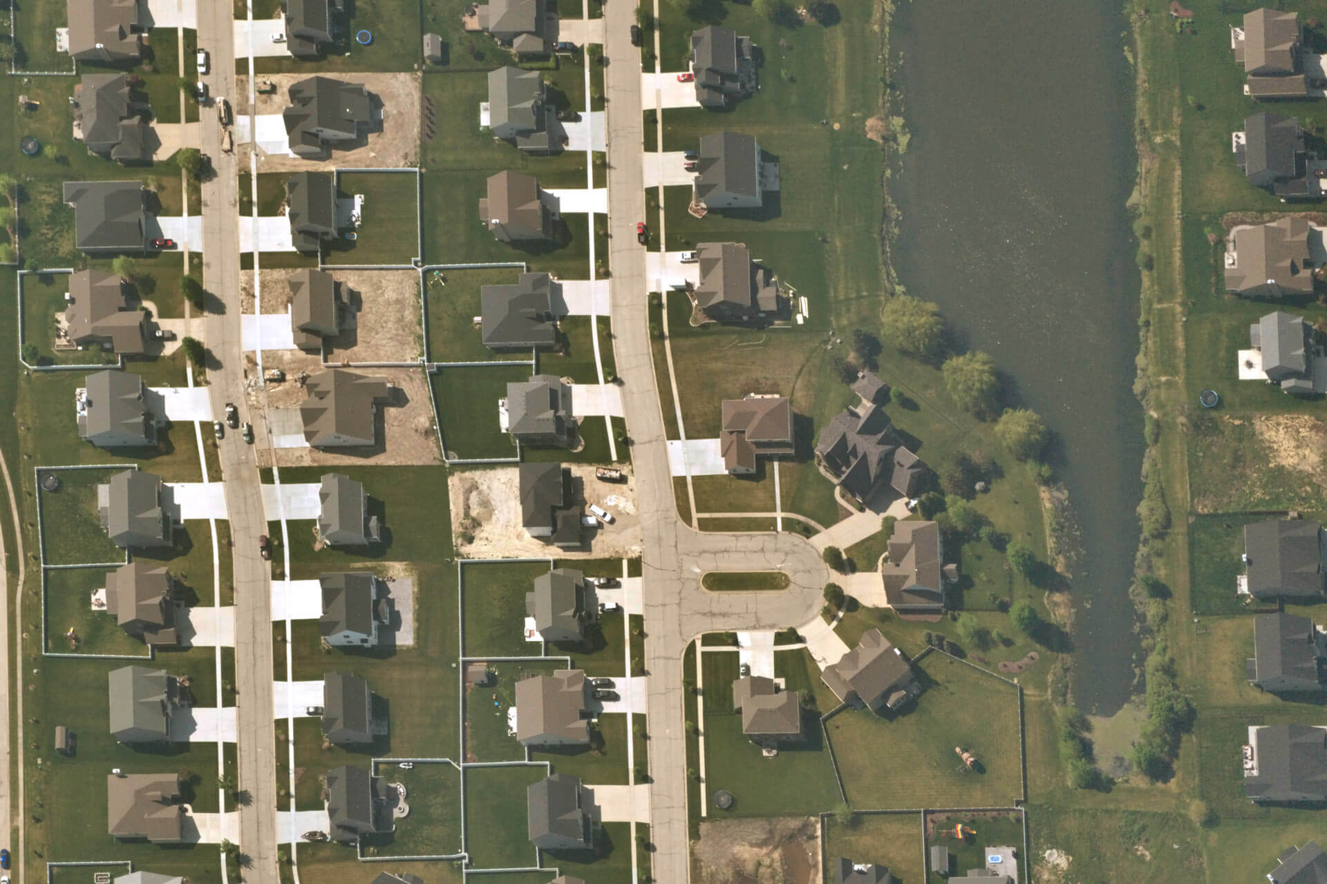
Another challenge digital cities face is collecting data in their areas of interest. A majority of the data from all sensor and innovation types are focused on the top 10 cities in the world, and even in those areas, the data can be stale and low-resolution. And if we limit ourselves to only building high-quality digital cities in top urban areas, how much value are we losing in smaller emerging cities, fast growing suburbs, high-value industrial sites, and our lifelines around farms and ranches?
All of these other areas have little to no coverage and outdated and unreliable data. As areas get further away from being categorized as a “top” city, we see a steep drop off in the overall coverage, resolution, recency, and quality of data collected. Thus, all of these underrepresented areas have weaker models helping them make critical decisions, which leads to problems such as failing structural foundations, missed opportunities around sustainability and urban planning, safety issues, inefficiencies, and higher costs. As access to high-quality data expands into these areas, new solutions will arise to make each area more productive. Such as the ability to map feedlots and crops in rural areas, understand how growing populations are affecting suburbs and growing cities, and track how climate change is affecting our environment.
But gaining access to these high-quality data sources is only one part of the solution. Ensuring the data is aligned together, and with your organization’s vision and end goal is essential to making your smart city come alive and prove real value.
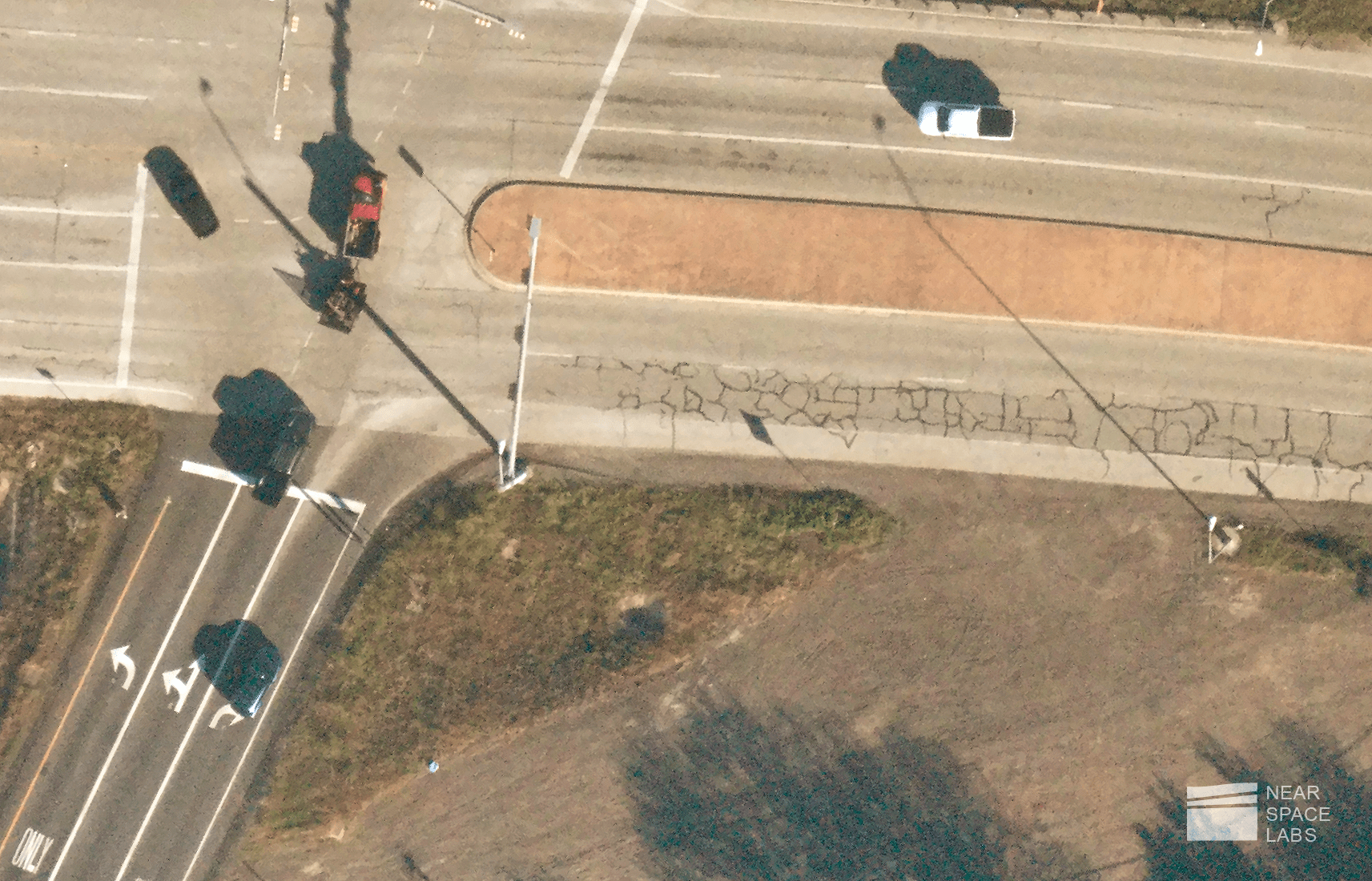
In an ideal world, smart cities would allow administrators to be proactive about their decision making, rather than reactive. To give an example, take this high-resolution image of an intersection taken by one of Near Space Labs’ Swiftys.

The road is visibly damaged and is riddled with alligator cracks, which is a strong indicator of earth movement and is usually caused by a weak supporting structure under the asphalt. High-resolution stratospheric, aerial, and satellite imagery can help identify damages like this at scale, but what’s next? We don’t know what may have caused this damage or how quickly we need to act before it gets worse.
Imagine layering this image over a map of the underground infrastructure.You now can see that a major pipe lays directly below the location of these alligator cracks and it may have burst. Now you gain the perspective of where the road is cracked, what caused the road to deteriorate at a faster pace than adjourning roads, and can build a plan to solve for how to resolve this problem and mitigate these safety hazards from occurring in the future.
Access to multiple forms of high-quality data paired with the understanding of how these different data sources align together is how reliable and powerful digital cities will be built.
How can stratospheric geospatial data enable Digital Cities?
Near Space Labs is a high-quality Earth imagery and geospatial data company providing governments, and businesses with high-resolution imagery to supplement other data and enable the build of digital and smart cities.
Challenges smart cities face in regards to high-quality optical imagery include accuracy, resolution, frequency and recency of capture, cloud coverage, and locations covered. Near Space Labs is helping solve these challenges using zero-emission stratospheric balloons, called Swiftys.


