Wildfires have emerged as a formidable and growing threat across the United States, impacting not only the economy but the environment and human health. Once considered a seasonal nuisance, these fires have become increasingly frequent and severe, fueled by the rising temperatures and prolonged droughts of climate change. In fact, according to the OECD, wildfire severity in the US increased 8 times from 1985 to 2017 on western forests, while the duration of the fire season extended more than 27% between 1979 and 2019. Urban expansion into previously undeveloped areas has also further exacerbated the problem, bringing homes and infrastructure dangerously close to fire-prone landscapes.
In this article, we’ll explore how emerging technologies, particularly stratospheric balloon systems with advanced imaging sensors, will become the go-to solution for tackling the challenges of increasingly intensifying wildfires. To set the stage, let’s first look at the impact of wildfires on our communities and environment, as well as the methods currently used for detection and monitoring.
Impacts of Wildfires: A Multifaceted Crisis
The impacts of wildfires are undeniably severe and continue to grow. In 2024, California experienced over 950 more wildland fires compared to the previous year, with an additional 583,000+ acres burned as of September 3, according to CAL Fire. This marks a 16% increase in acres burned compared to the 5-year average. In turn, the consequences of active wildfires lasting longer, spreading faster, and burning larger areas, can be greatly damaging:
- Environmental Impacts: Wildfires devastate natural ecosystems, destroying wildlife habitats and contributing to the loss of biodiversity. In addition, places like rainforests, permafrost, and peatlands—areas that usually don’t burn—are drying out and becoming more susceptible to fire. As fire-prone areas grow, the release of greenhouse gasses (GHGs) from burning vegetation exacerbates climate change, creating a vicious cycle of environmental degradation.
- Social Impacts: The effects on human health are severe, both physically and mentally. Wildfire smoke can lead to respiratory problems, while the trauma of evacuations and loss of homes takes a toll on mental well-being. The destruction of properties not only displaces families but also erodes community stability.
- Economic Impacts: A number of different sectors feel the financial impact of wildfires. Forestry and agriculture suffer from the loss of land and resources, tourism industries face declines due to damaged landscapes, and healthcare systems are strained by the increased demand for emergency services. Long-term health costs of U.S wildland fires were estimated to be $450 billion dollars, according to the Environmental Protection Agency (EPA). The financial burden on businesses and local governments can also be staggering, with billions of dollars spent annually on firefighting and recovery efforts.
As firefighters and ground crews are typically the first line of defense, their ability to respond quickly and effectively is crucial.
Current Methods for Wildfire Detection and Monitoring
Traditionally, wildfires have been detected and monitored using a mix of ground-based and aerial methods. Detection implies both finding new fires previously not identified and confirming those reported by third parties (for instance, hikers), whereas monitoring means following the evolution of the fire event, being able to pinpoint the active front, the direction and speed, and its intensity.
For many years, wildfire detection and monitoring relied on ground resources such as firefighter patrols, volunteers, and watch towers, but these methods had significant limitations in terms of speed and coverage. Eventually, aircraft, including planes and helicopters, were brought in to help by flying over high-risk areas during peak fire seasons. While useful, this approach is expensive and often constrained by the time it takes to deploy and how long the aircraft can remain airborne. This limits the ability to intervene before fires escalate and makes continuous monitoring difficult, as planes and helicopters must refuel frequently.
The introduction of satellite and remote sensing technologies enabled the detection and monitoring of wildfires from space, but with notable trade-offs. Geostationary satellites offer continuous coverage but at a low spatial resolution (3-5 km). While Low Earth Orbit (LEO) satellites provide higher resolution with pixel sizes in the tens of meters, the long revisit times—spanning several days—make real-time monitoring impractical. More recently, small UAVs (drones) have been used for affordable, localized forest monitoring, though they are limited by short flight durations and range, making them unsuitable for extended or large-scale missions.
As the limitations of these traditional methods remain, firefighters and first responders are forced to work with incomplete and delayed information. Thus, with wildfires becoming increasingly harder to manage, relying solely on these outdated solutions is no longer viable for ensuring the safety of our first responders, communities, and the environment.
Stratospheric Balloon Technology: The Future of Wildfire Management
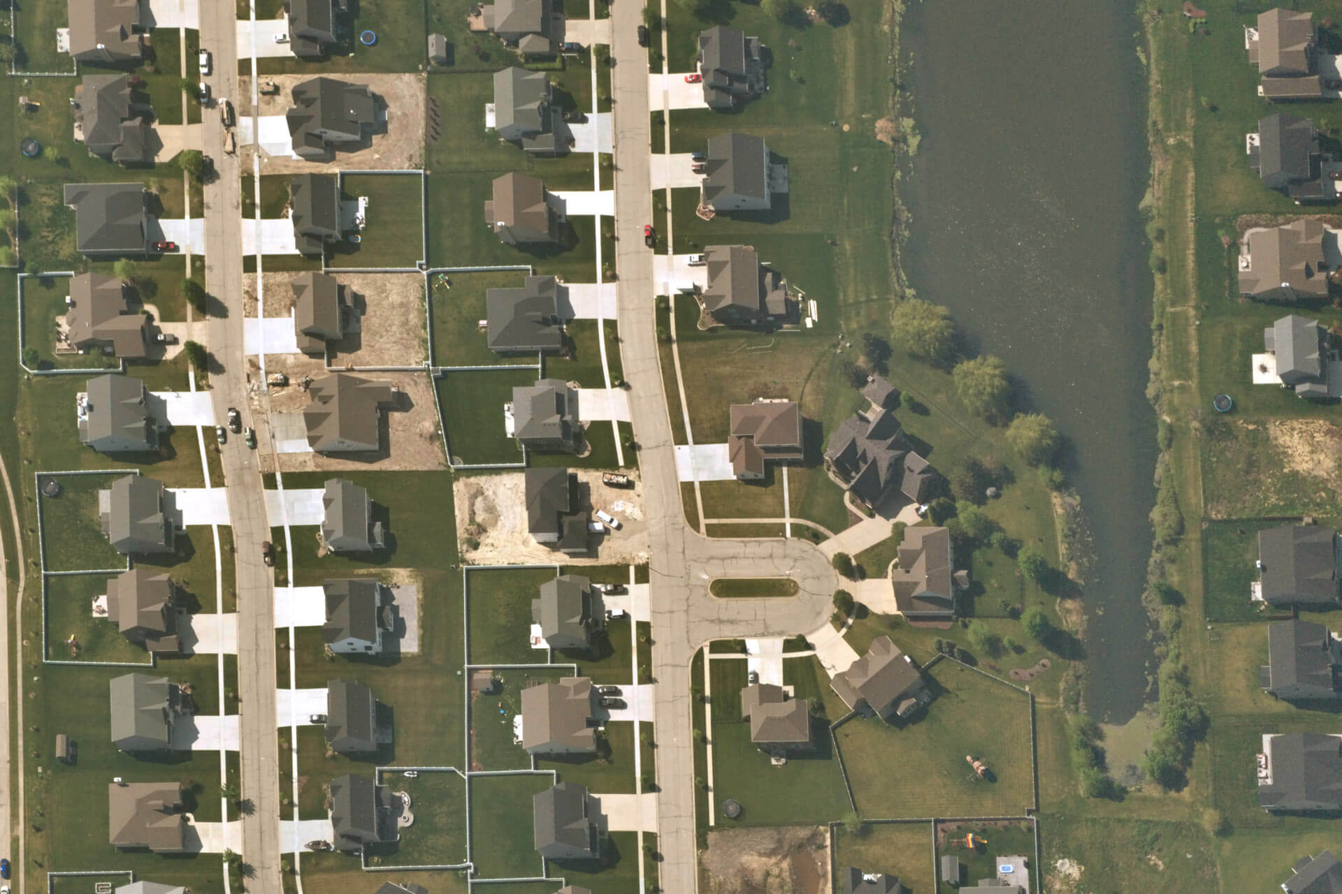
To date, stratospheric balloon technology has been used for various commercial purposes, including mitigating insurance claims losses, infrastructure and utility inspections, and urban planning. They typically collect imagery using RGB sensors that capture the same color spectrum as what people see. For early detection and monitoring of wildfires, advanced infrared sensors are essential to quickly identify preliminary signs of fire, such as thermal anomalies or smoke plumes, which may not be visible to the naked eye or detectable with standard RGB sensors. Infrared sensors are able to “see through smoke,” detecting fires through sensing heat, light, and chemicals (like CO2) generated by active fires. Plug-and-play platforms —flown via stratospheric balloons— that can support the seamless integration of specialized sensors offer a revolutionary advancement in wildfire management.
The advantages of balloon systems that many commercial businesses benefit from also apply to wildland fire management: wide aerial coverage, high-resolution images, and lower costs. Their long flight times allow for continuous monitoring and real-time communication with ground crews, while high-resolution infrared imagery helps detect small fires early, preventing them from spreading. With a lightweight design and low operating costs, these systems also help provide equitable coverage in all regions and communities. Furthermore, stratospheric balloons stay clear of the airspace surrounding the fire region and do not interfere with firefighting extinguishing operations.
Data captured from advanced imaging sensors via stratospheric balloons can support several key use cases:
- Active Wildland and Wildfire Monitoring: Stratospheric imagery can provide comprehensive coverage and continuous monitoring of vast and remote areas in real-time. This is particularly valuable for tracking and predicting how fires evolve in hard-to-reach locations where conventional methods fall short.
- Remote Area Reconnaissance: In areas where there are suspicions of a wildfire, stratospheric imagery can conduct thorough reconnaissance without the need for physical presence. This early detection capability helps in assessing the situation and planning more strategic, quick, and appropriate responses.
- Enhanced Emergency Response and Resource Allocation: Real-time data from stratospheric imagery enables emergency crews to coordinate timely evacuation efforts and optimally deploy resources where they are most needed, whether that’s directing crews to critical hotspots or strategically positioning firefighting equipment.
This is exactly what Near Space Labs plans to utilize it’s unique stratospheric balloon technology, the Swift, for in the coming years. In fact, The United States Department of Agriculture (USDA) awarded Near Space Labs a $170,000 grant to further develop this technology to effectively manage wildfires on forest lands. The grant will advance Near Space Labs’ research and development efforts to design and build new sensor payloads and earth imaging platforms, facilitating longer flights, higher resolution captures, and real-time data transfer capabilities. These improvements will support the most sophisticated wildfire detection and monitoring system available.
Synergy with Emerging Technologies
In recent years, new technologies have emerged that complement data from stratospheric balloons, all of which share the goal of advancing wildfire monitoring and increasing situational awareness. For example, aerial imagery can be integrated into mapping tools like Fire AI, creating a single, authoritative interface that supports tactical decision-making. Ground systems, such as Pano AI’s advanced camera towers or IoT sensor networks, can work alongside aerial data to provide a more complete view of the situation from both the ground and the sky. Additionally, technologies for risk management and firefront modeling, like Technosylva’s, will benefit from timely, higher-quality data, improving predictions of firefront evolution.
Next Steps: Adoption and Integration with Key Partners & Tools
While stratospheric balloons built for specific wildfire detection and monitoring use cases are an emerging technology that Near Space Labs is building, success in this space will depend on various factors, including establishing strategic partnerships and being able to integrate the data with existing tools and models already under use by key stakeholders.
For example, command centers and fire response units are much more likely to adopt new data pipelines that are able to be seamlessly integrated into their existing workflows. This calls for strong partnerships between key stakeholders: data and technology providers, federal and state fire agencies, environmental organizations, and local governments.
Near Space Labs is working with various organizations to understand top priorities for wildfire management use cases in order to build a highly efficient and effective solution. For example, the team at NASA has brought Near Space Labs into the conversation to share their needs and explore strategies for using High Altitude Platforms (HAPs) in various wildfire applications, including clearing airspace for suppression efforts, smoke and smoke trail detection, and nighttime monitoring.
In Conclusion
Rising temperatures from climate change have bolstered a fire-friendly environment, with more frequent heat waves, drier air and soil, and increased lightning-induced fires, among many other effects. With greenhouse gas emissions continuing to rise, researchers predict the risk of large wildfires will increase sixfold by mid-century in parts of the US. As climate change intensifies, traditional methods of detecting and monitoring wildfires are no longer fast or effective enough to give emergency teams the situational awareness they need in order to allocate resources efficiently, protect themselves and nearby communities, and stop fires from spreading.
Near Space Labs’ mission is to help mitigate the effects of climate change through the use of their zero-emission stratospheric balloon technology. By advancing their platforms to carry sophisticated sensors and deliver real-time data, they will set a new standard for wildfire prevention and management. This sustainable approach not only strengthens the capabilities of firefighters but also supports economic stability, public health, and enhances our collective resilience against the growing threat of wildfires. With robust partnerships and innovative solutions, we can forge a safer future for our communities and safeguard our environment from the escalating risks of climate change.


