Increase profitability and customer satisfaction with Near Space Labs’ high-resolution, high-frequency geospatial data
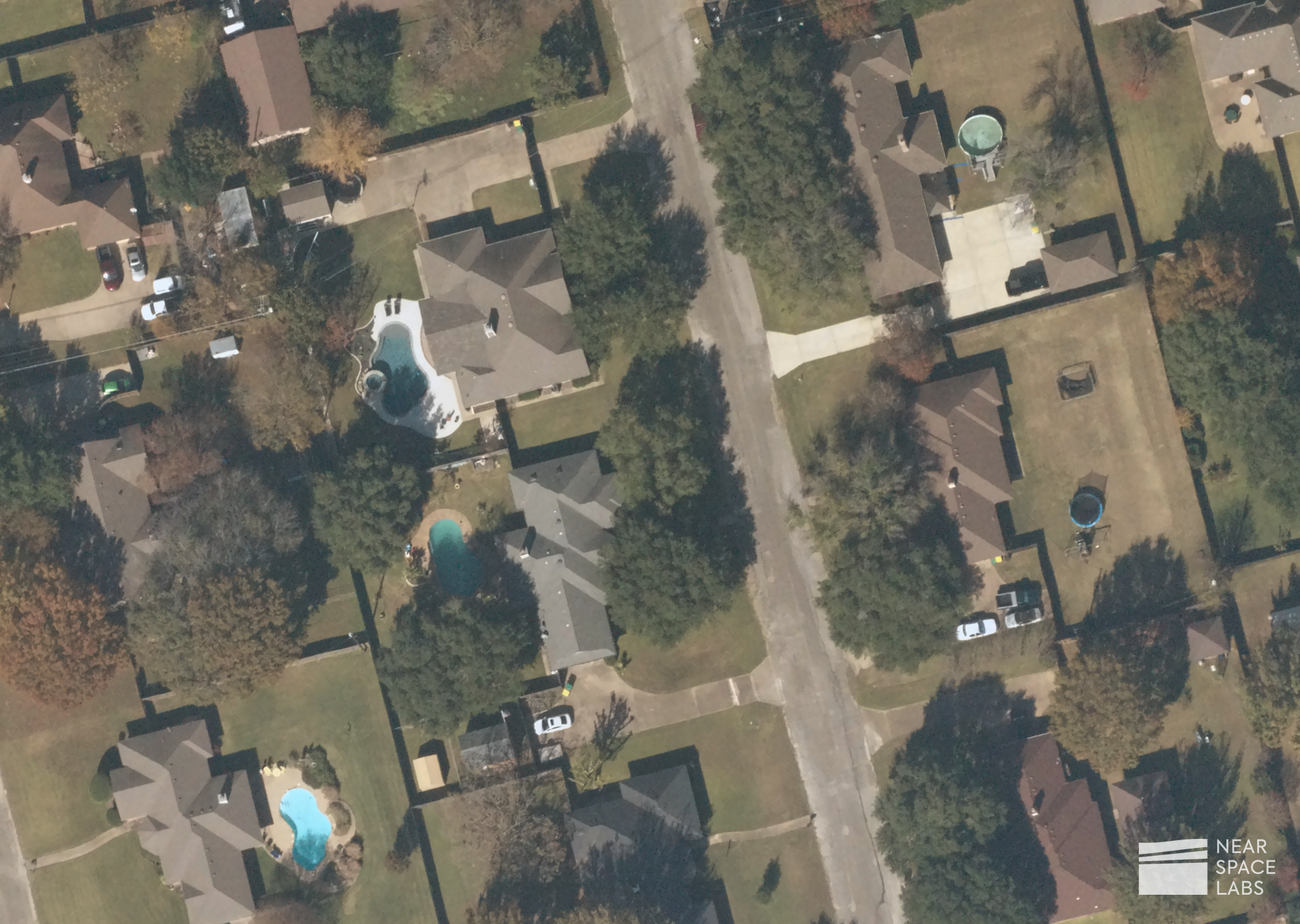
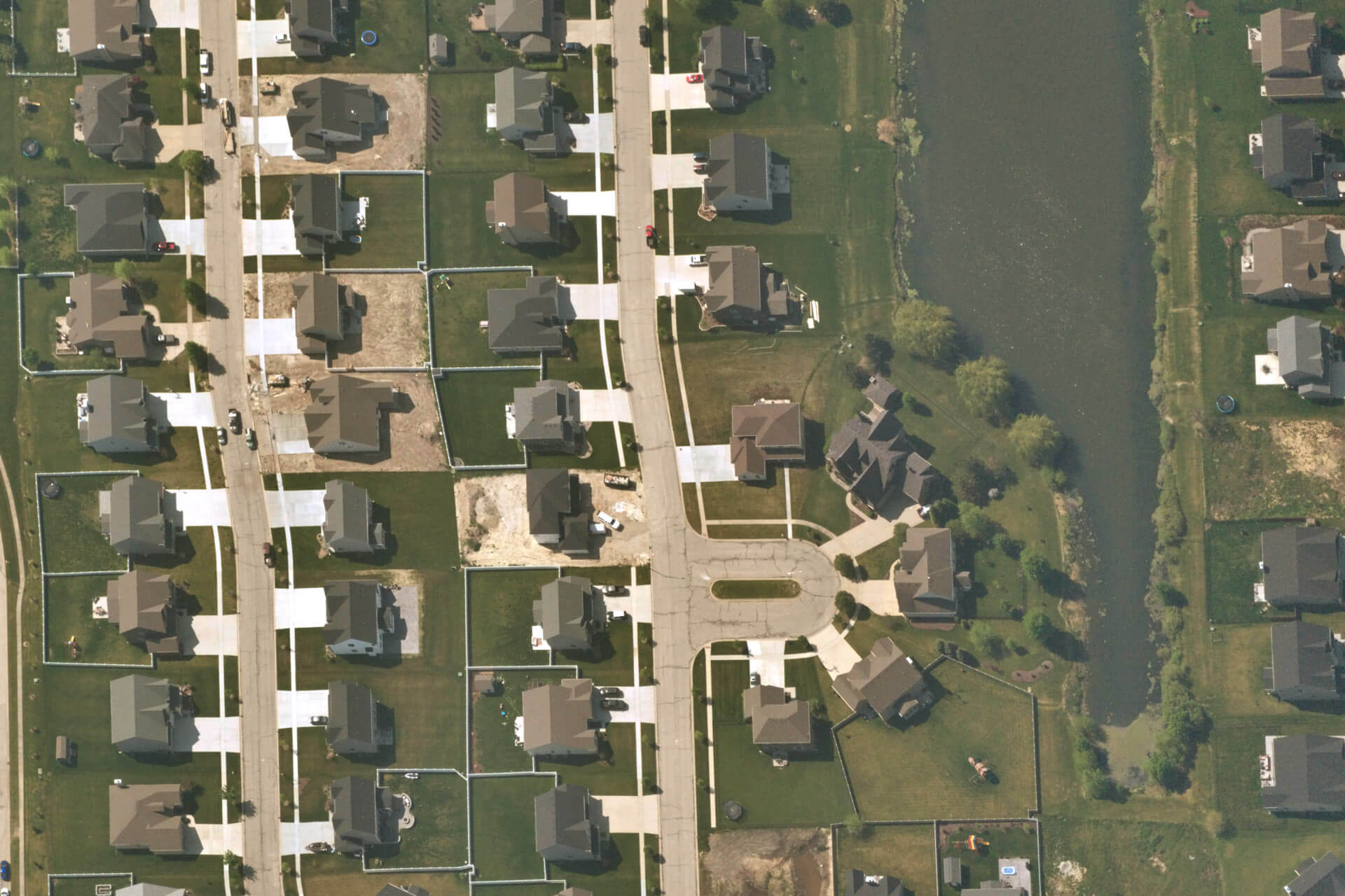
With Near Space Labs’ frequently updated and high-resolution imagery, insurance underwriters are empowered with the most accurate data to evaluate risk and make profitable decisions. Stratospheric remote sensing offers a scalable, holistic, and high-resolution view of commercial and residential properties allowing visualization of physical and environmental changes as they occur. Identify new liability risks like swimming pools, trampolines, tree overhang and other potential hazards or use our imagery to run proximity analysis’ to understand if properties fall into natural hazard zones (ie. flood zones, wildfire zones, industrial zones, seismic zones, etc.).

Residential properties showing swimming pools, trampolines, and surrounding landscapes. Near Space Labs. December, 2021.
With our zero-emission stratospheric robots called, Swiftys, we reduce the need for on-site inspections, saving insurance organizations valuable time and money with indisputable, time-stamped, georeferenced imagery. During remote inspections, our imagery captures details such as the conditions of buildings, roofs, solar panels, and surrounding vegetation in order for insurance organizations to assess the magnitude of risk and update their policies more quickly and precisely.
Near Space Labs is accelerating the underwriting process by providing high-resolution Earth imagery to the market without compromising on recency or the scale of area captured. This crucial data helps insurance organizations not only become more profitable, but drive better business by helping reduce customer wait times and increase customer satisfaction.
Benefits of Near Space Labs’ imaging for underwriting
There are multiple advantages of adding Near Space Labs’ imagery into your underwriting workflows – whether you’re replacing your imagery provider or supplementing your existing data.
High Frequency and Recency
Near Space Labs has a proven track record around capturing and delivering images with high recency to our clients. Our baseline archived imagery is updated every 90 days, which means accurate property insights at the time of underwriting for more precise and advantageous policies.
Tasking for Specific Areas of Interest
The nimbleness of our Swifty allows our team to mobilize, launch, and capture imagery from nearly anywhere and at any time of the day. We offer coverage of the top 100 most populous cities and take tasking requests for suburban, rural, farm, and other remote locations that are not currently captured by other imagery providers.
High-Resolution at Scale
Near Space Labs captures large swaths of 10 cm resolution images. Flying at twice the height of a commercial airplane, our Swiftys capture 1,000 sq km of images per flight (approximately 187,000 football fields) and our high-resolution images allow customers to see details such as roof cracks, building damages, and additions of swimming pools or fountains, to name a few. Our resolution captures almost everything a drone is able to see, but at a much greater scale. Rather than taking the time and cost to fly a drone over small areas, our Swiftys capture high resolution images in a more efficient, cost effective way.
At Near Space Labs, we’re dedicated to providing high-quality data with zero tradeoffs between resolution, frequency, scale of capture, and sustainability, using an eco-friendly solution to enable more enhanced and profitable solutions for the insurance industry.


