Location data is a critical tool for property and casualty insurers to better serve their customers and remain competitive. Every policy and its associated risks are influenced by location, and local data allows insurance professionals to understand and manage risks at every stage — from initial quotes to claim assessment and payment.
While most insurers are using some form of location data today, the local imagery data available to them is often refreshed only once or twice a year. Currently, this information is primarily generated using drones, satellites or planes. However, the technical, regulatory and cost limitations of these systems limit the insights that can be derived from these platforms. With this landscape, customers are typically forced to choose between resolution, frequency, flexibility and cost. Imagery is a powerful tool for insurers, but much less so if the data is outdated or low-resolution.
At Near Space Labs we have developed a high-altitude flying platform capable of imaging an entire city, every day, in high resolution and with flexible scheduling. This unprecedented technology is changing the aerial imaging market and unlocking new opportunities for the insurance industry, with recent imagery made available at the time of pricing or claim assessment. In this article we examine three applications that this technology unlocks for insurance. This is just the beginning of boosting your company’s performance in underwriting risks and assessing risk concentrations.
Improve underwriting decisions and portfolio performance
Near Space Labs offers a cost neutral platform that can be leveraged to quickly and accurately understand and underwrite risk. This improvement in underwriting decisions allows companies to reduce downstream costs from claims and remain competitive. Underwriters need a clear picture of flood, wildfire, hurricane, property characteristics such as building materials, and other property risks. Get a more informed and complete picture from our data to make your underwriting decisions.
Tom Miller Dam is the upstream dam in the Red Bud Trail that forms the Lady Bird lake in Austin. All the properties close to the coasts of Lady Bird lake are under a high flood risk. It is estimated that in case of a failure on the dam approximately 2000 housing units, office buildings, commercial sites will be affected, 21 bridges will be in peril, causing about $530M in property damage.
 Downtown Austin as captured by Near Space Lab’s Swift platform.
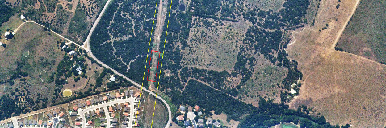
Near Space Labs’ highly updated imagery allows to identify areas with high wildfire risks — one of the most common causes of which is vegetation encroachment on power lines. In the image below the suburban areas close to the power line are in a high risk zone, because of the powerline close by. Notice the area marked by red, where the vegetation growth became dangerously close to the lines and crossed the buffer zone around them.
 The dangerous vegetation encroachment market by red poses a high risk of fire for the houses below. Source Near Space Labs
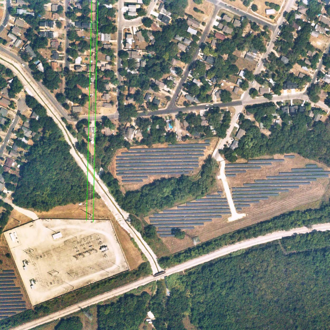
In a similar example below the houses close to the power substation and the power line are also in a high risk zone.
 Solar plant and a suburban substation. Source Near Space Labs
Fire risk exposure can be discounted by the proximity of fire stations though. In the example below the underwriting of the properties in downtown should consider the fire station proximity.
Exposure management
Identify and visualize patterns in your risk exposure across an entire territory. Near Space Labs can image an entire city within hours, allowing you to quickly and easily collect data across multiple territories in your portfolio. With our data, you can develop a unified view of portfolio risk by examining regional concentrations.
Remotely and quickly respond to catastrophe claims
With Near Space Labs’ on-demand imaging, your team can quickly understand firm-wide exposure and immediately respond to claims both during and after catastrophe events. Our data enables companies to first quickly predict and allocate resources required to respond to such events, and then reduce analyst time required to assess, prioritize, and respond to claims. Understanding the impact of an event, developing a targeted response strategy, and evaluating claims quickly allows companies to rapidly and effectively serve customers during a crucial time. Reach out to Near Space Labs to reduce your time-to-close for claims and help your customers recover from losses faster.
Sign-up here for a free trial, and check out our API here.


